Direct answer
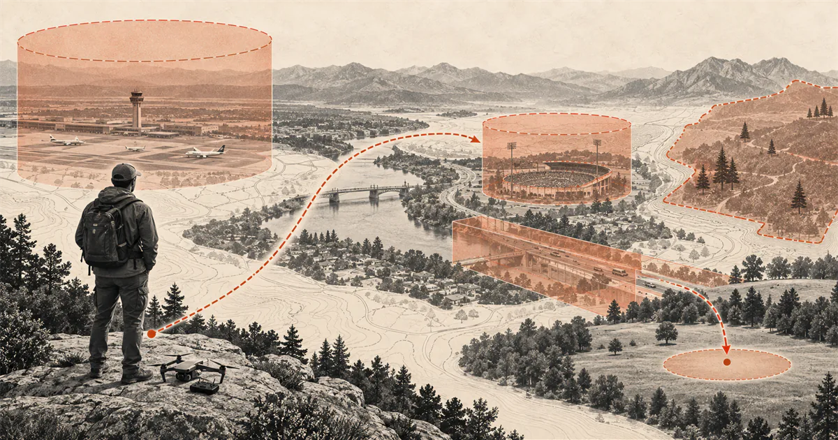
Clear the airspace, the launch site, and the physical area as three separate decisions.
Search the exact location and planned time in a current FAA-approved B4UFLY service, inspect any restrictions, and obtain prior FAA authorization if the flight enters controlled airspace. Then confirm that the landowner or site manager permits takeoff and landing, and walk the area for people, traffic, wires, obstacles, weather, and a safe landing option. A green map indication alone is not complete permission to fly.
Start with the purpose of the flight
This guide covers a small drone flown in the United States only for personal enjoyment under the recreational exception. A business, work, public-safety, research, or other non-recreational purpose may require Part 107 or another authority even when nobody pays for the flight.
Use the US recreational drone rules decision map first. Complete TRUST, determine registration, and resolve Remote ID before treating a map result as the only gate.
Search the exact place and time
Use one of the providers on the FAA’s current B4UFLY list. Search the launch point, the entire intended route, the planned altitude, and the expected flight time. A result for a nearby address, a wide map view, or a screenshot from an earlier day is not the same check.
B4UFLY can show controlled airspace, special-use airspace, airports, critical infrastructure, national parks, military training routes, and Temporary Flight Restrictions. Read the details behind the status indicator. A simple color cannot explain every condition that applies to the operation.
Recheck close to takeoff. TFRs and other restrictions can appear after the first planning session, and weather or activity at the site can change independently of the map.
Identify the airspace decision
In Class G uncontrolled airspace, a recreational flyer may operate at or below 400 feet while meeting all other recreational requirements. Controlled airspace around airports requires prior FAA authorization and operation at or below the authorized altitude.
Where LAANC is available, an FAA-approved service supplier can process an eligible request. Where it is not available, the applicable route may be FAA DroneZone. Follow the LAANC guide for recreational flyers instead of treating an awareness map as an authorization.
Do not call an airport tower as a substitute for the current authorization process unless an authorization specifically tells you to do so. Do not assume that being several miles from an airport proves the airspace is uncontrolled.
Check temporary and special restrictions
Temporary Flight Restrictions apply to drones and can cover major sporting events, presidential movements, disasters, security activity, and other limited-time conditions. Read the controlling notice for its location, altitude, dates, times, and exceptions. A recreational plan should not assume that a general LAANC approval overrides a TFR.
Also inspect any prohibited, restricted, special-use, or security-sensitive area identified by the current FAA service. If the status or boundary is unclear, do not launch until the controlling source resolves it.
Confirm takeoff and landing access
FAA airspace authority does not grant access to the ground. State, local, territorial, or tribal authorities may restrict takeoff and landing at a park, beach, campus, trail, historic site, or other managed place. A private owner can also control use of the property.
Read the current rule for the exact site and obtain permission where required. Check posted signs, official land-manager pages, permits, opening hours, event conditions, and any rule that applies to operating equipment from the property. Airspace authorization does not cancel a ground restriction.
Inspect the physical operating area
Once airspace and access are clear, use the safe practice area guide to inspect the real place. Look for people, animals, roads, moving vehicles, wires, trees, structures, antennas, loose debris, unstable surfaces, and changing wind.
Choose a primary landing point and a realistic alternate. Keep the full route within visual line of sight and preserve enough space to give way to other aircraft. A legally available site can still be unsuitable for the aircraft, the pilot, or the current conditions.
Run the location check again
Before takeoff:
- Confirm the flight is purely recreational.
- Search the exact location and time in a current FAA-approved service.
- Read every restriction and authorization condition.
- Confirm takeoff and landing access with the landowner or site manager.
- Check TFRs, weather, people, obstacles, and the alternate landing area.
- Stop if any permission, boundary, or condition remains unclear.
Keep the relevant proof or authorization available during the operation, then complete the broader drone preflight checklist.
Sources
Check the underlying guidance.
The FAA sources below define the current B4UFLY service, controlled-airspace authorization, temporary restrictions, and the separation between airspace and takeoff or landing rules. Recheck the exact place and time before every flight.
- B4UFLY, Federal Aviation Administration. Government source. Checked . Used for the current FAA-approved situational-awareness service route and the information those services provide.https://www.faa.gov/uas/getting_started/b4ufly
- Recreational Flyers & Community-Based Organizations, Federal Aviation Administration. Government source. Checked . Used for current recreational airspace, altitude, visual-line-of-sight, right-of-way, and authorization requirements.https://www.faa.gov/uas/recreational_flyers
- No Drone Zone, Federal Aviation Administration. Government source. Checked . Used to separate federal airspace restrictions from state, local, territorial, tribal, and site-specific takeoff or landing restrictions.https://www.faa.gov/uas/resources/community_engagement/no_drone_zone
- Temporary Flight Restrictions, Federal Aviation Administration. Government source. Checked . Used for the requirement to check current NOTAMs and the time-sensitive nature of TFRs.https://www.faa.gov/uas/getting_started/temporary_flight_restrictions
Editorial disclosure: This guide organizes current FAA location resources for US recreational flyers. It is not airspace authorization, land-use permission, legal advice, or a live determination that a specific place is available.